Anawangin Cove

San Antonio, Zambales

Pinto Art Museum

Antipolo, Rizal

Mt. Maculot

Cuenca, Batangas

Mt. Pulag

Kabayan, Benguet

Sabang Beach

Baler, Aurora

July 17, 2014

An Infographic Guide to Mt Naguiling

Thinking out of the box and looking to cater to those people who view the pictures of the trip, more than reading the whole article has inspired me to create this infographics just for you, my fellow outdoor trippers!

An Infographic Guide to Mt Naguiling

Updated: July 2014

Mt. Naguiling or Mt. Nagiling is believed to be the highest peak among the Lobo-San Juan Mountain Range. It is not a popular hiking destination, and it has only been recently that a handful of brave souls attempted and successfully reached it's summit.


Although, the infographics herein shows a brief summary, it is still advised to check out the full details and special concerns for this trip HERE.

~ CBT

June 6, 2014

Mount Apo: Kapatagan - Kidapawan Itinerary

A Guide to Hiking Mt. Apo

Jump-Off: Kapatagan, Brgy. Mainit, Digos
Exit point: Lake Agco, Kidapawan City
MASL: 2956 meters
Ascent: 2 days (6-8 hours / day) / Descend: 12 hours
Specs: Major Climb, Difficulty 7/9

Mt Apo with a dry Lake Venado on the foreground.

Mt. Apo is most famously known as the highest mountain in the Philippines. It stands 2956 meters above sea level and is home to many unique plants and animal species, most notable of which is the Philippine Eagle. It has 4 major trails: Kapatagan and Sibulan, Sta. Cruz in Davao Del Sur, and Kidapawan and Magpet Trail in North Cotabato.

Assault via Kapatagan Trail

The Kapatagan Trail features farmlands which is an open trail starting from the jump-off, and is approximately 2 hours of hike before entering the covers of the mountain's forest. Upon entering the forest, the goal is to reach either one of the 2 campsites: Godi-Godi campsite, which is the most preferred campsite due to it's large flat area; and the Baroring campsite, a small patch of flat land in the middle of the forest. Reaching either campsites marks the end of the first day's trek towards the summit of Mount Apo.
"Since our group started late in the morning, our first night in the mountains led us to camp at Baroring. The nights in Mt. Apo may not be as cold as Mt. Pulag, however, the weather can still bring about hypothermia if not appropriately prepared and dressed."
Godi-Godi Campsite

The next feature of Kapatagan Trail will take you to the scenic Boulder trail, where huge piles of rocks are stacked on top of each other which leads you to a unique view of one of Mt. Apo's Sulfur vents. The volcanic features of the mountain are most prominent here in this trail, and is one of the sights to behold in this adventure. Strong winds can fan the smoke from the sulfur vent making it difficult to breathe and/or to keep one's eyes open.

mt-apo-sulfer-vent

Boulder trail and Sulfer vent

After a steep ascent on the boulders, leads to a plateau dubbed as the "white sand" due to the area being covered with beach-like sand that is white in color. One last assault, and this will finally take you to the crater of Mt. Apo, and just a few minutes to the summit.

apo-white-sand
At White Sand 


mt-apo-craterapo-crater

The Crater of Mt. Apo 


A Fog laden summit at Mt. Apo.

Descending via Kidapawan Trail

Upon reaching the summit, there are 2 options to camp for the night. One is approximately 10 minutes away from the summit which is known as the "Summit Camp". The name maybe daunting, but the campsite is more being on the "shoulder" of the summit where the mountain walls protects the camp from strong winds. The other option is continuing the traverse from the summit all the way to Lake Venado.

 At the Summit Camp
"Despite our trek being slowed down by downpours, we were able to successful reach the summit safe and sound. Though, thick clouds were present at the time and were not graced to view the surrounding areas, we are never the less, very thankful to have reach the peak without injuries, to have seen what we had saw, and to have experienced an adventure, not everyone is keen on taking."
Lake Venado is an ideal camping area due its vast grass lands. It also houses a sari-sari store where provisions such as cooked local delicacies and sodas are being sold for a hefty price. From Lake Venado, the trail splits to the now closed Mainit Trail, where one passes close enough for a glimpse of the Mainit waterfalls. It was named as such due to its warm waters being mixed with hot sulfur. This Trail is permanently closed due to the dangers of landslides, however, some still passes through it especially if pressed for time. The Mainit Trail also  features 9 river crossings and is shorter by approximately 1 hour compared to the Koong Trail, which is currently the main trail to and from Lake Venado to Lake Agco. Kidapawan Trail highlights Lake Venado, mossy forest, and river crossings.

lake-venado-mt-apo
A view of Lake Venado

 One of the many heart stopping river crossings;
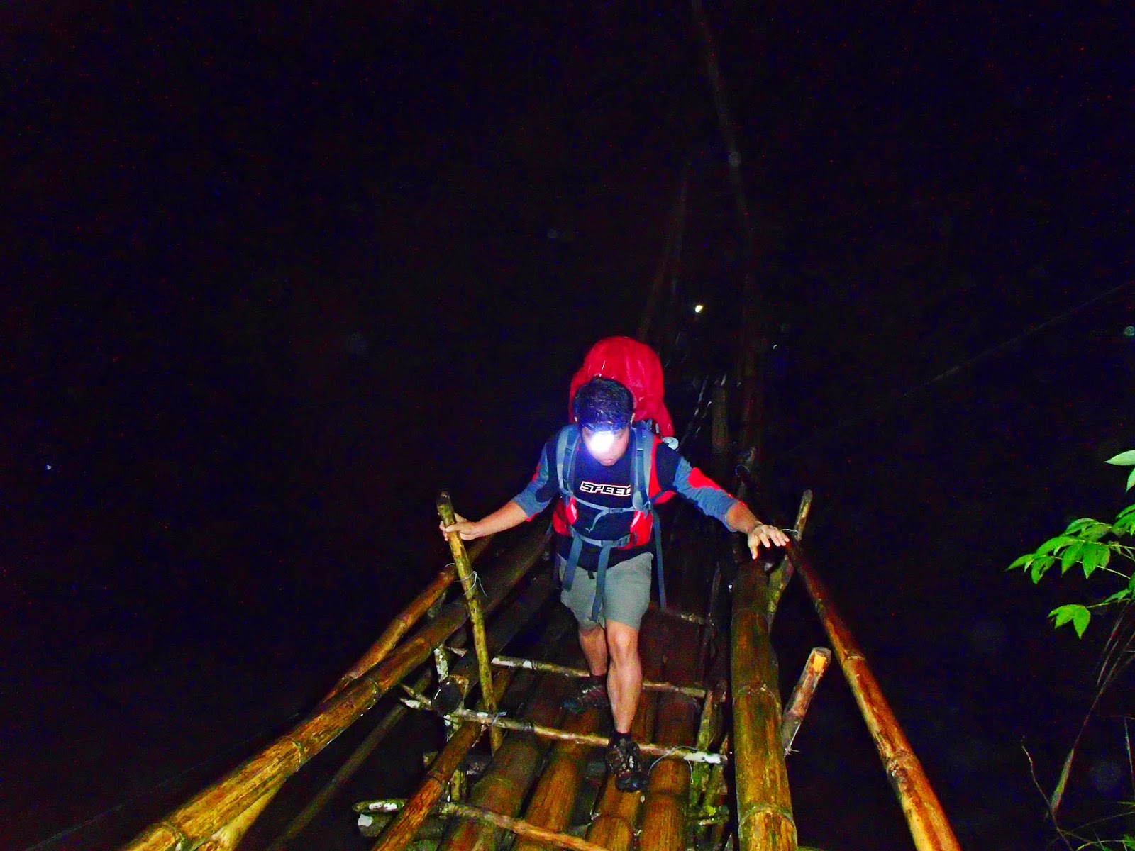
And the huge bamboo bridge that marks the end of the adventure.

ITINERARY

Day 0:

0300 PM - ETD Davao to Digos
0430 PM - ETA Digos City and proceed to Kapatagan
0530 PM - ETA Kapatagan to Brgy. Mainit, Jump-off
0630 PM - ETA Brgy.Mainit

Day1:

0600 AM - Wake-up Call / Breakfast
0800 AM - Start trek
1130 AM - ETA Upper Sabwang / Lunch
1230 PM - Resume Trek to Baroring
0130 PM - ETA Baroring to Godi-Godi campsite
0330 PM - ETA Godi-Godi / Set-Up Camp
0600 PM - Prepare Dinner and Socials

Day 2:

0500 AM - Wake-up Call
0600 AM - Breakfast and Pack Lunch / Break Camp
0800 AM - Start trek to Boulders
1200 NN - ETA Boulders / Lunch
0100 PM - Resume Trek
0300 PM - ETA White Sand
0400 PM - ETA Mt. Apo Crater
0430 PM - ETA Mt. Apo Summit
0500 PM - ETA Summit Camp / Set-Up Camp
0600 PM - Prepare Dinner and Socials

Day 3:

0500 AM - Wake-up Call
0600 AM - Breakfast and Pack Lunch / Break Camp
0800 AM - Start Trek to Lake venado
1100 AM - ETA Lake venado / Lunch
1200 NN - Resume Trek via Koong Trail
0500 PM - ETA Lake Agco at Mahomanoy Mountain Resort

Optional Side Trip: Davao City and Samal Island

EXPENSES

Our estimated cost of our trip per head were more or less 3500 PHP for a DIY. Since we were not too familiar with the area, we opted to get a guide to assist us with the trip. Keeping in mind each and every one's safety and security was the most important aspect of our trips, and having contingencies through a trusted and recommended guide would definitely matter in dire situations.

Mt. Apo Trip: 3500 PHP (Includes Entry and Exit fees: 500 php each equating to 1000 PHP per head)
Guide: 800 PHP / day
* Porter: 500 PHP / day
Lake Agco Expenses:
Entrance: 35 PHP
Tent Space: 25 PHP
* Entrance to Lake Agco: 10 PHP
* Optional

SPECIAL CONCERNS


  • Transportation (One of the reasons we opted for a coordinator, as it would save us time and effort.)
    • Jeepney that goes to Kapatagan can be found at the SM Ecoland Terminal.
  • Mobile signal in between hikes are intermittent
  • Prepare accordingly for cold nights and ensure to pack rain gears.
  • Water sources are available. Confirm with your guide to ensure that you and your group are  well supplied and adequately hydrated.
  • From Lake Agco, you may take a Habal-habal going to Digos which costs approximately 100 PHP each.

ACKNOWLEDGEMENT

Special Thanks to Angeline Tan for the organization and planning of the trip, Bal AcuƱa for the reliable guideship and in assisting with the needed requirements, The porters and the team for the photos, videos, the companionship and the memorable experience.

Guide Contact: Bal AcuƱa - +63 9081911580


Trip date: May 22 - 24, 2014


~ CBT


April 30, 2014

Mt Tapulao: Poor Man's Pulag

Mt Tapulao Palauig, Zambales

Jump-off: Sitio Dampay, Brgy. Dampay-Salaza, Palauig
Days required / Hours to summit: 1-2 days / 6-12 hours
Specs: Major Climb, Difficulty 6/9
MASL: 2037

Mt. Tapulao stands at 2037 MASL and is the highest peak among the Zambales Mountains which includes the famous Mt. Pinatubo. It is also known as the High Peak, but is most commonly known to mountaineers as the Poor Man's Pulag due to it's pine trees and chilly weather, similar to that of Mt. Pulag in Benguet.

Mt. Tapulao is located in Palauig, Zambales and it's seemingly endless trail of stones are due to a previous chromite mining operation. To date, you can still see tracks of heavy equipment, embedded in some parts of the trail. Having said that, the trails are wide and open, making hikers directly exposed to the heat of the sun. Only after going past the 10 KM point, is where the weather starts to cool, and the scenery begins to gradually change.

Panoramic image of one of the scenic trails in Mt. Tapulao

The trek from the jump-off to the summit is an 18 KM hike with about 85-90% being inclined. It becomes even more difficult on a rainy day as the water flows freely trough the wide trail creating deep puddles of mud, with some trails opening up to a shallow crevice. Stone markers are set up every 2 KM which allows you to pinpoint your distance to the summit and back.

Mt. Tapulao's trail is not at all confusing. From the jump-off, you'll be passing by a few houses and then veering right on to the mining road which marks the start of the trail. The only fork you'll encounter next is close to the 6 KM point where a road to the left goes to PAGPAI campsite and nursery (See first photo below). Take the road straight ahead, keeping right, and in a few meters, you'll reach the first water source.

 The sudden downpour spared us from the heat,
but created an obstacle of muddy trails and slippery rocks.


Notes

  • Jump-off and registration is from the Dampay resettlement area in Brgy. Salaza in Palauig
  • Water Sources are located in the 6 KM, 10 KM and at 16KM points.
    • The water source at the 16 KM point is located at the Bunker Houses, which is approximately another 300 meters of trek from camp site 2.
  • Bunker houses can be used if you are hiking in a group of 1-3 persons only. However, it is not advisable to camp at the bunker house during bad weather as the foundations of this bunkers are no longer trustworthy.
 Water source signage at the site of the old mining bunker houses.

 An old that's rusty and forgotten.

Getting to Tapulao

  • Take the night trip of Victory Liner to Sta Cruz, Zambales. approximate cost for a one way trip is 350 pesos.
  • Ask the driver to drop you off at Dampay-Salaza. From the main road, you will get off on a rough road to your right. This road is located in the opposite side of a power pylon. So look for a power pylon to the left, opposite a dirt road to the right. Tricyles usually await hikers on this dirt road.
  • Take a 45 minute tricycle ride towards the jump-off. That should be approximately cost 200-250 pesos.
  • For the return trip, make sure to ask the trike driver to pick you up at the jump-off. From jump-off to Iba bus terminal will cost approximately 300-400 pesos.
* Ensure that you're able to take note of the bus schedule for the return trip to prevent delays.


Left: Heaps of Chromites are left abandoned since the cessation of the 
mining operations in Mt. Tapulao. Right: Sunset at Mt. Tapulao

Tapulao Itinerary

Day 0

11:00 PM - ETD Sta. Cruz-bound Victory Liner bus from Caloocan terminal.
+: Alternatively, Iba-bound buses are also possible, however, will require you to take a trike from the terminal up to the jump-off, instead of taking the trike from Dampay-Salaza.

Day 1

03:30 AM - ETA Dampay-Salaza. Arrange for tricycle to jump-off.
0:500 AM - ETA jump-off point. Register at the Welcome Center, start trek.
0:900 AM - ETA first water source
12:00 NN - ETA second water source. Lunch
05:30 PM - ETA ‘Bunker’, set up camp at campsite of choice
06:00 PM - Dinner, socials

* you may extend climbing time indefinitely as night trek is possible

Day 2

05:10 AM - Start trek to summit
06:00 AM - ETA summit
06:30 AM - Back to campsite
07:30 AM - Breakfast, break camp
08:30 AM - Start descent
12:00 NN - ETA second water source. Lunch
02:00 PM - ETA first water source
05:00 PM - Back at jump-off point. Take tricycle back to Iba
06:00 PM - Take bus to Manila
11:00 PM - ETA Manila

Expenses

  • Bus: 2-way - Approx. 700 PHP
  • Trike from Dampay Salaza: 1-way - Approx. 200-250 PHP / 3-4 pax
    • +: Trike from Iba Bus Terminal: 1-way - Approx. 400-450 PHP / 3-4 pax 
  • Registration Fee: 30 PHP
  • Guide: 700 PHP


Special Concerns

  • During the day, the open trails can leave one prone to sunburn and other heat related concerns. On the other hand, nights at Mt Tapulao can be very cold, therefore one should pack accordingly.
  • During wet weather, limatik or forest leeches abound especially near the streams along the way.
  • Pack light as much as you can. The trail is long and can take approximately 10 hours going up, and about half the time going down.
  • Mt. Tapulao is a test of patience and endurance. Ensure that you are physically and mentally ready before taking the challenge!

~ City Boy Tripper


April 28, 2014

Bongao Peak of Bongao, Tawi-Tawi

Bud Bongao: The Sacred Mountain of Bongao, Tawi-Tawi

By: A. Tan

Standing approximately 314 MASL, Bud Bongao or Bongao Peak is one of the landmarks in Bongao, Tawi-Tawi in Southern Mindanao. Bud Bongao (“Bud” is a local word for mountain) is considered as sacred by the people of Bongao and nearby places. They believe that it has the power to heal sickness and cleanse people from their sins. Bud Bongao’s trail is gradual and anyone, even those who don’t have experience in hiking can climb this mountain.

Together with some friends from the Tawi-Tawi’s environmental office, we started our journey to the holy mountain at 7:00 in the morning. We were advised to bring bananas because our "monkey-friends", whom they believe as the guardians of the sacred mountain, will expect to be fed.

Most of my companions do not hike mountains so the climb took longer than usual. At the middle of the trail, the guardian monkeys were waiting for us. We took out the bananas and gave them one by one. Monkeys in this mountain are very friendly; they will not harm you most especially if you will hand them their favorite food.

 These monkeys welcome visitors who offers them their favorite treat.

Since I am a self-confessed photo addict, I took the opportunity to have my pictures taken with the "guardian monkeys". Aside from the monkeys, you will also see plastic strips tied around tree branches. This is due to the locals’ belief that if you do so, your wishes will come true.

After an hour of hiking, we reached the place where the tombs of the Muslim Imams/ leaders are located. I saw two tombs at the area. We were guided by one of our local friends inside the tomb. With a ten-peso coin in hand, I made my wishes and prayed inside the cloth line surrounding the tomb. Make sure to leave your foot wear behind before entering the area as the practice requires one to go in bare footed.

After paying our respects, we then continued our journey to the peak of the mountain. Upon reaching the summit, we were amazed by the panoramic view from the top. The wide open sea, the airport and other nearby islands including Simun’ul, which we later visited, were just a sight to behold. Our hike took us about an hour and thirty minutes to get to the mountain peak.

 Bird's eye view of the open sea.

The airport runway clearly visible from the summit.

That day is also the national day of protest against Pork Barel Scam. So with our printed posters, we joined our brothers and sisters in the protest while we were at the peak of Bongao. After some picture taking and short rest, we started our descent. We were back at the jump off point after an hour, after which we continued our tour of Tawi-Tawi.

Abolish Pork Barrel!

How To Get There

  • Take a flight from Zambonaga to Tawi-Tawi, Philippine Airlines and Cebu Pacific each have one morning flight.
  • There are resorts and some transient hotels in Bongao which usually have more rooms available due to the limited numbers of visitors in the area.
  • There are available fast craft and ferries that travel from Zamboanga City to Tawi-Tawi, but please take note that they only have trips 2-3 times a week. It is much more advisable to take a plane since the fare costs almost the same if you will take advantage of the promo fares.
  • The only means of transportation in Tawi-Tawi are tricycles. You can just hire a tricycle to bring you to wherever you wish to go.
  • There’s no registration fee or guide fee in Bongao Peak, but it is advisable to have someone from the place as your guide. The usual practice of the tourists in the area is by hiring a tricycle driver to take them to the peak as well as accompanying them up Bud Bongao. Extra fees are then arranged.
  • Since the sacred mountain is inhabited by troops of local monkeys, do not forget to bring bananas with you as these mountain guardians will surely ask for it.
  • Although the locals tie plastic strips on the branches of trees as part of their tradition, local government office most especially the local DENR discourages visitors to do the same. Please always follow the “Leave No Trace” principle in every mountain and in any places you visit.
  • And lastly, since Mindanao's religion predominantly practices Islamic traditions, always be mindful of the culture and beliefs of our Muslim brothers and sisters. Wear appropriate clothes at all times to avoid unnecessary attention while you are in the area.


April 2, 2014

Mt Daguldul and Naambon Falls

Mt. Daguldul and Naambon Falls

San Juan, Batangas
Major jump-off: Brgy. Hugom, San Juan
MASL: 672
Hours to summit: 5 hours
Specs: Minor climb
Difficulty: 3/9

By: A. Tan


Mt. Daguldul or Daguldol is one of the few mountains in Luzon that has a jump-off that is close to the beach. This coastal mountain standing approximately 672 meters above sea level is also a part of the mountains connecting the Lobo-San Juan Mountains which includes Mt. Naguiling.

The mountain features, Naambon Falls, rolling slopes and a refreshing swim at the beach.
"We started our journey by meeting each other at 8:30 AM in KFC Buendia. We then headed to the JAM liner terminal to take a bus going to Lipa. We departed from Buendia by 9:00 AM and reached Lipa City at around 11:00 AM.

We had a short restroom break, and then rode a jeepney going to San Juan. It took us 45 minutes to reach San Juan Market. Since it’s almost lunch time and everybody was starving, we decided to have our lunch in one of the karinderyas near the market. While the others were ordering food, we went to the market to buy our provision for our planned overnight hike.

After our lunch, we immediately headed to Bgry. Hugom and reached the area at almost 2:00 in the afternoon. The jeepney brought us straight to the registration area. We settled our registration fee for 35.00 each and paid the 350 pesos guide fee. There was an option to have the guide stay overnight with us for a fee of 700 pesos but we saw that there were a lot of mountaineers so we just decided to have the guide accompany us only in going up.

We started trekking at around 2:30 in the afternoon; the first part of the trail seemed like a never-ending path of sand which I found very exhausting. It took us approximately 25 minutes to get passed the last beach resort which I believe was La Luz, and about another 5 minutes to reach the foot of Mt. Daguldul.

According to some blogs / pages that we visited when we were researching about the mountain, the trail is gradual. However, I got easily exhausted due to the sand trail which was followed by the assault trail. Another reason could possibly be my lack of preparation. We reached the famous place of Mang Lizardo, who passed away years ago according to the local who was his relative, at around 4:30 PM. We rested for a while, ate buko, washed the ingredients for the sinigang then continued hiking.

Unfortunately, the guide that was assigned to us wassn't so friendly. He kept on telling us that if we will walk on our pace the possible time to reach the camp site is 9:00 PM. We reached the camp site at half past six in the evening.
 
We immediately pitched our tents and prepared our dinner. What we apparently missed out on our research is that the place could be very cold during night time. Luckily with good food and good company, we survived the chilly evening. We had our short but enjoyable socials before calling it a night.
We woke up the next day at 6:00 in the morning just to find out that dogs have taken all our food. However the good thing is that our cooking items were left untouched. Having said that, we just drank our coffees and proceeded immediately to the summit, although, it was not the kind of summit that I imagined it to be. After a short period of taking pictures we headed back to the camp site and prepared what remained of our breakfast before breaking camp.
The trail going down was relatively easier since it seems about 90% of the trail was going down. Seeing that we were already in the area, we visited the famous Naambon falls. Naambon falls is just near the first kubo, in the Niyugan area from the jump off.
We were back in the jump off at exactly 12:00 noon. We had a short rest in one of the cottages along the beach. They billed us 100 pesos each with free use of the cottage. We were supposed to swim, but due to a very tiring hike, we just took a rest, cleaned ourselves and fixed our things.

One of the groups who rented a jeepney offered us to just ride with them. We were lucky to have paid just 150 pesos each from the jump off to SM Lipa City grand terminal. We were back in Manila at past 7:00 in the evening.
Indeed another wonderful experience in the mountain with friends!"

Significant Hours

Manila to Lipa bus ride: 2 hours
Lipa to San Juan Jeepney ride: 45 minutes
San Juan to Brgy. Hugom Jeepney ride: 45 minutes
Trek: 5 hours

ITinerary

Option #1: Camp at the Mountain

Day 1:
07:00 AM - Assembly Time at KFC Buendia
09:30 AM - ETA Lipa/ Jeep to San Juan
10:30 AM - ETA San Juan/ Jeep to Brgy. Hugom
11:50 AM - ETA Brgy Hugom/ Register/ Arrange Guide/ LUNCH
01:00 PM - Start Trek
03:00 PM - ETA mang Lizardo’s Place
05:00 PM - ETA Niyugan Campsite/ Set Camp/ Prep Dinner
07:00 PM - Dinner / Socials

DAY 2:
05:00 AM - Wake Up call (Coffee, tea or Me)
05:15 AM - Trek to Summit
05:40 AM - ETA Summit/ Sun Rise Viewing
06:30 AM - Descend
07:00 AM - Breakfast/ Break Camp
08:30 AM - Descend
10:00 AM - Back at Mang Lizardo’s Place
11:00 AM - ETA Naambon Falls
12:00 NN - Resume Descend
01:00 PM - ETA Jump Off/ Beach
03:00 PM - ETD to Lipa
04:30 PM - ETA Lipa/ Take Bus to Manila
07:00 PM - ETA Manila

Option #2: Camp on the Beach

Day 1:
06:00 AM - Assembly Time at KFC Buendia
08:30 AM - ETA Lipa/ Jeep to San Juan
09:30 AM - ETA San Juan/ Jeep to Brgy. Hugom
10:00 AM - ETA Brgy Hugom/ Register/ Arrange Guide/ LUNCH
10:30 AM - Start Trek
12:00 NN - ETA Mang Lizardo’s Place/ Packed Lunch
02:00 PM - ETA Niyugan Campsite/ Summit
03:00 PM - Descend
05:00 PM - ETA Naambon Falls
05:30 PM - Resume Descend
06:30 PM - ETA Jump Off/ Set Camp at the Beach Area/ Dinner and Socials

DAY 2:
06:00 AM - Wake Up call / Breakfast
12:00 NN - Break Camp / LUNCH
12:30 PM - ETD Jeep from Brgy. Hugom to San Juan
01:15 PM - ETA San Juan/ Take Jeep to Lipa
02:15 PM - ETA Lipa/ Take Bus to Manila
05:00 PM - ETA Manila

Expenses

* Note that the expenses are based on 10 participants

Bus from Manila - Lipa (Round trip) = 198.00 PHP

Option 1:
Chartered Jeepney from Lipa to Brgy Hugom - 4000 PHP / 10 pax

Option 2:
Jeepney ride from Robinson Lipa to San Juan and back (Round trip) = 100.00 PHP
Jeep San Juan to Bgry. Hugom and back (Round trip)  = 80.00 PHP

Registration Fee= 35.00
Guide Fee -350.00 per day / 10 pax (no. of pax is based on assumption) = 35.00
Food= 150.00

TOTAL (Commute based on 10 pax) = 810.00
TOTAL (Rent a charted jeep from Lipa to Brgy Hugom based on 10 pax) = 1,630.00

Special Concerns

  • The last trip of Jam liner bus from Lipa City to Manila is 8:00 PM however you can go to SM City Lipa to catch other bus lines
  • Last trip of jeepneys from San Juan to Lipa City is 8:00 PM
  • Jeepneys from Bgy, Hugom to San Juan is until 12 noon but you can take a tricycle from the registration area to take you to the jeepney terminal going to San Juan
  • You can also try to arrange with other climbers who rented chartered jeepney if they can still accommodate your group. This is advisable to small groups like ours.
  • Make sure to keep your food inside your tent or the dogs will be happy eating your food.
  • Make sure to hang your garbage bags to the trees or the dogs will scatter your garbage. 


~ City Boy Tripper


Social Profiles

Facebook Pinterest Google Plus Email