
A Guide to Hiking Mt. Apo
Jump-Off: Kapatagan, Brgy. Mainit, DigosExit point: Lake Agco, Kidapawan City
MASL: 2956 meters
Ascent: 2 days (6-8 hours / day) / Descend: 12 hours
Specs: Major Climb, Difficulty 7/9

Mt Apo with a dry Lake Venado on the foreground.
Mt. Apo is most famously known as the highest mountain in the Philippines. It stands 2956 meters above sea level and is home to many unique plants and animal species, most notable of which is the Philippine Eagle. It has 4 major trails: Kapatagan and Sibulan, Sta. Cruz in Davao Del Sur, and Kidapawan and Magpet Trail in North Cotabato.
Assault via Kapatagan Trail
 The Kapatagan Trail features farmlands which is an open trail starting from the jump-off, and is approximately 2 hours of hike before entering the covers of the mountain's forest. Upon entering the forest, the goal is to reach either one of the 2 campsites: Godi-Godi campsite, which is the most preferred campsite due to it's large flat area; and the Baroring campsite, a small patch of flat land in the middle of the forest. Reaching either campsites marks the end of the first day's trek towards the summit of Mount Apo.
"Since our group started late in the morning, our first night in the mountains led us to camp at Baroring. The nights in Mt. Apo may not be as cold as Mt. Pulag, however, the weather can still bring about hypothermia if not appropriately prepared and dressed."

Godi-Godi Campsite
The next feature of Kapatagan Trail will take you to the scenic Boulder trail, where huge piles of rocks are stacked on top of each other which leads you to a unique view of one of Mt. Apo's Sulfur vents. The volcanic features of the mountain are most prominent here in this trail, and is one of the sights to behold in this adventure. Strong winds can fan the smoke from the sulfur vent making it difficult to breathe and/or to keep one's eyes open.


Boulder trail and Sulfer vent
After a steep ascent on the boulders, leads to a plateau dubbed as the "white sand" due to the area being covered with beach-like sand that is white in color. One last assault, and this will finally take you to the crater of Mt. Apo, and just a few minutes to the summit.


At White Sand


The Crater of Mt. Apo


Descending via Kidapawan Trail
Upon reaching the summit, there are 2 options to camp for the night. One is approximately 10 minutes away from the summit which is known as the "Summit Camp". The name maybe daunting, but the campsite is more being on the "shoulder" of the summit where the mountain walls protects the camp from strong winds. The other option is continuing the traverse from the summit all the way to Lake Venado.

At the Summit Camp
"Despite our trek being slowed down by downpours, we were able to successful reach the summit safe and sound. Though, thick clouds were present at the time and were not graced to view the surrounding areas, we are never the less, very thankful to have reach the peak without injuries, to have seen what we had saw, and to have experienced an adventure, not everyone is keen on taking."Lake Venado is an ideal camping area due its vast grass lands. It also houses a sari-sari store where provisions such as cooked local delicacies and sodas are being sold for a hefty price. From Lake Venado, the trail splits to the now closed Mainit Trail, where one passes close enough for a glimpse of the Mainit waterfalls. It was named as such due to its warm waters being mixed with hot sulfur. This Trail is permanently closed due to the dangers of landslides, however, some still passes through it especially if pressed for time. The Mainit Trail also features 9 river crossings and is shorter by approximately 1 hour compared to the Koong Trail, which is currently the main trail to and from Lake Venado to Lake Agco. Kidapawan Trail highlights Lake Venado, mossy forest, and river crossings.


A view of Lake Venado

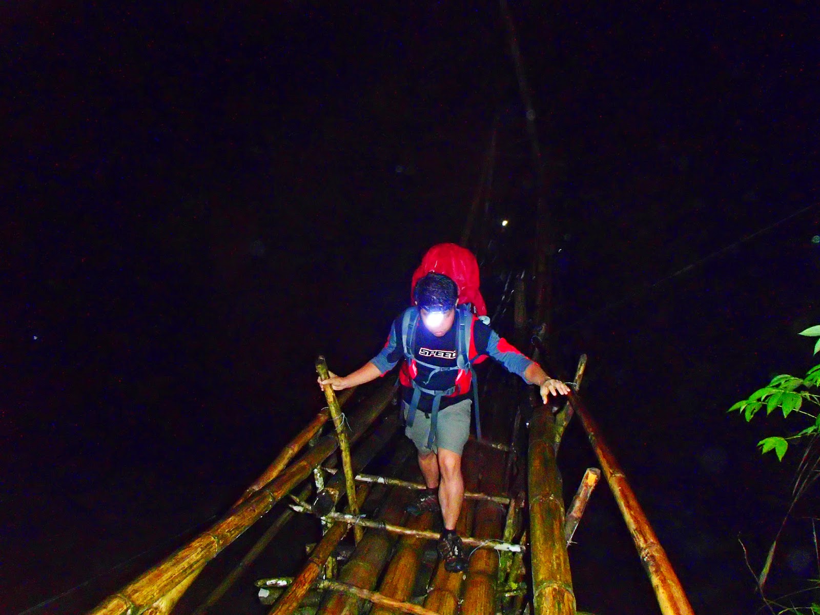
One of the many heart stopping river crossings;
And the huge bamboo bridge that marks the end of the adventure.
ITINERARY
Day 0:0300 PM - ETD Davao to Digos
0430 PM - ETA Digos City and proceed to Kapatagan
0530 PM - ETA Kapatagan to Brgy. Mainit, Jump-off
0630 PM - ETA Brgy.Mainit
Day1:
0600 AM - Wake-up Call / Breakfast
0800 AM - Start trek
1130 AM - ETA Upper Sabwang / Lunch
1230 PM - Resume Trek to Baroring
0130 PM - ETA Baroring to Godi-Godi campsite
0330 PM - ETA Godi-Godi / Set-Up Camp
0600 PM - Prepare Dinner and Socials
Day 2:
0500 AM - Wake-up Call
0600 AM - Breakfast and Pack Lunch / Break Camp
0800 AM - Start trek to Boulders
1200 NN - ETA Boulders / Lunch
0100 PM - Resume Trek
0300 PM - ETA White Sand
0400 PM - ETA Mt. Apo Crater
0430 PM - ETA Mt. Apo Summit
0500 PM - ETA Summit Camp / Set-Up Camp
0600 PM - Prepare Dinner and Socials
Day 3:
0500 AM - Wake-up Call
0600 AM - Breakfast and Pack Lunch / Break Camp
0800 AM - Start Trek to Lake venado
1100 AM - ETA Lake venado / Lunch
1200 NN - Resume Trek via Koong Trail
0500 PM - ETA Lake Agco at Mahomanoy Mountain Resort
Optional Side Trip: Davao City and Samal Island
EXPENSES
Our estimated cost of our trip per head were more or less 3500 PHP for a DIY. Since we were not too familiar with the area, we opted to get a guide to assist us with the trip. Keeping in mind each and every one's safety and security was the most important aspect of our trips, and having contingencies through a trusted and recommended guide would definitely matter in dire situations.
Mt. Apo Trip: 3500 PHP (Includes Entry and Exit fees: 500 php each equating to 1000 PHP per head)
Guide: 800 PHP / day
* Porter: 500 PHP / day
Lake Agco Expenses:
Entrance: 35 PHP* Optional
Tent Space: 25 PHP
* Entrance to Lake Agco: 10 PHP
SPECIAL CONCERNS
- Transportation (One of the reasons we opted for a coordinator, as it would save us time and effort.)
- Jeepney that goes to Kapatagan can be found at the SM Ecoland Terminal.
- Mobile signal in between hikes are intermittent
- Prepare accordingly for cold nights and ensure to pack rain gears.
- Water sources are available. Confirm with your guide to ensure that you and your group are well supplied and adequately hydrated.
- From Lake Agco, you may take a Habal-habal going to Digos which costs approximately 100 PHP each.

ACKNOWLEDGEMENT
Special Thanks to Angeline Tan for the organization and planning of the trip, Bal Acuña for the reliable guideship and in assisting with the needed requirements, The porters and the team for the photos, videos, the companionship and the memorable experience.Guide Contact: Bal Acuña - +63 9081911580
Trip date: May 22 - 24, 2014


